Malta Map
Detailed Road Map of Malta
Malta Map - Zoomable road map of Malta, a small island country in the Mediterranean Sea, situated to the south of Sicily.
Using the buttons on the top left you can 'zoom' and 'pan' to get a detailed road map of Malta and plan your visit to the country. It is also possible to view the Malta islands, towns and resorts of Gozo, Comino, Valletta, Mosta, Sliema, Rabat and St Paul's.
The Republic of Malta comprises 7 islands, with a population of around 420,000, located to the south of Sicily in the Mediterranean Sea. In an important strategic location, Malta has been settled over the centuries by various cultures and civilizations including Sicilians, Phoenicians, Romans and Byzantines.
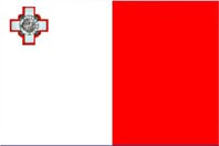
Forever linked with the Knights Hospitaller who for many centuries controlled the island, it later became known as "George Cross Island", after the entire island was awarded the George Cross by British King George VI, for the loyalty and bravery of its people during the Second World War.
These days Malta is a popular holiday destination enjoying a temperate Mediterranean climate, with hot, dry summers and mild winters. The airport for Malta (malta International Airport) is located about 8 kilometres from the capital Valletta.
Malta Links: Malta Weather
Related: Travel Articles - Other Places - Arpora Map - Builders
HOME
